WIP - Metro Manila's Esteros and Rivers
It took 2 weekends and several instances of breaking this website to properly render this first work-in-progress post. I’m still trying to get a handle on Hugo as my static website framework (sometimes I think I should have gone with something more simpler such as Wordpress, Blogger or Wix). But I digress.
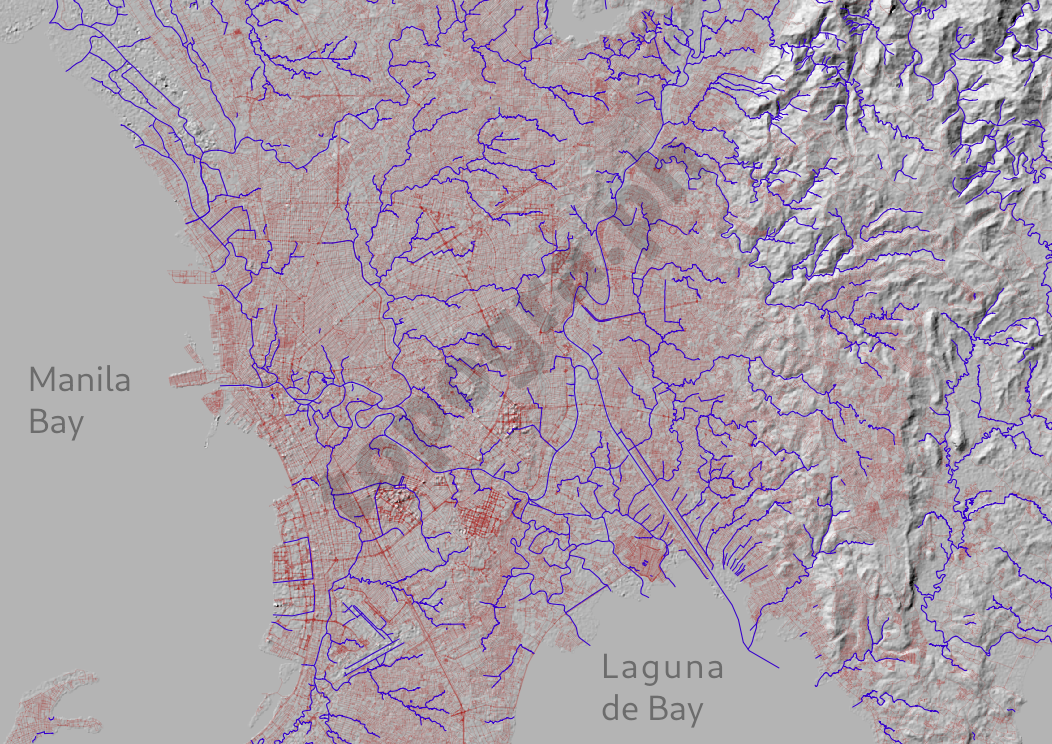
Thanks to the tireless work of Openstreetmap volunteer mappers and NASA’s open data I was able to quickly sketch the map below. I overlaid the waterways (blue) over the road network (red) over the terrain texture generated from a digital elevation model.1 The effect is immediate and clear: much of our estero systems have disappeared from our line-of-sight. What is less immediate, and requires a bit more imagination: using the full potential esteros and rivers as part of our routes to aid our mobility around the metropolis.2
Metro Manila's Hidden Hydrology
The hillshade was rendered in QGIS from the Shuttle Radar Topography Mission’s digital elevation model (DEM) and the vector overlays of roads and waterways from Openstreetmap data.